

Dholera TP Scheme
Dholera TP Scheme, Survey Number & Final Plot Explained
Understand Dholera TP Scheme, Survey Number, Original Plot and Final PlotNumber in simple language before checking maps or buying property.Introduction
TP Scheme, Survey Number and Final Plot
Number in Dholera Explained
When buyers start exploring property in Dholera, they often come across terms such as:
- Survey Number
- TP Scheme
- Original Plot Number
- Final Plot Number
- Development Plan
- Zoning
These terms can sound complicated, especially for first-time land buyers.
However, understanding them is extremely important because a land parcel may appear differently in
revenue records, Town Planning maps and final planning documents.
Dholera SIR uses the Town Planning Scheme mechanism as part of its planned urban development
framework. Official Dholera planning information states that Town Planning Schemes 1 to 6 cover about
422 sq. km of the developable area.
This guide explains the most commonly used Dholera land terms in simple language so buyers can
better understand maps, project information and property discussions.
First, Understand the Basic Land Journey
The easiest way to understand the process is: Survey Number → Original Plot → Final Plot
These numbers are related, but they do not always refer to exactly the same shape or area of land.
In simple terms:
- Survey Number identifies land in the traditional revenue record.
- Original Plot (OP) represents land brought into the Town Planning Scheme.
- Final Plot (FP) is the reconstituted plot identified through the Town Planning Scheme process.
Official Dholera TP maps specifically show Original Plot and Final Plot plans, demonstrating how land
parcels are represented before and after reconstitution.
What Is a Survey Number?
A Survey Number is a basic land-identification number used in revenue records. It helps identify a particular piece of land within a village.
For example, land records may refer to something like:
Survey No. 125
or
Survey No. 125/1
The exact format can vary depending on subdivision and revenue records.
Think of the Survey Number as the land’s original revenue identity.
It helps connect the property to records such as:
- Ownership information
- Village records
- Revenue records
- Land area
- Subdivisions
- Historical transactions
For a property buyer, the Survey Number is one of the first pieces of information that should be
requested.
Why Is the Survey Number Important inDholera?
A Google Maps location or project brochure is not enough to identify land legally.
Two plots may look close to each other on a marketing map but may have different:
- Survey Numbers
- Ownership
- TP Scheme status
- Zoning
- Road impact
- Final Plot allocation
- Development potential
That is why buyers should ask:
What is the exact Survey Number of the land?
Once the Survey Number is known, it becomes easier to trace how that land appears within applicable
planning and revenue records.
What Is a Dholera TP Scheme?
TP Scheme stands for Town Planning Scheme.
A Town Planning Scheme is a planning mechanism used to convert a large area of existing land parcels
into an organised urban layout.
Instead of developing a city based only on old agricultural parcel boundaries, the TP process can
reorganise land to create infrastructure such as:
- Roads
- Utilities
- Public facilities
- Open spaces
- Industrial areas
- Residential areas
- Commercial areas
- Other planned uses
Dholera officially uses the Town Planning Scheme mechanism under Gujarat’s planning framework to
implement its Development Plan. Official Dholera information identifies TP Schemes 1 to 6 across the planned development area.
Why Does Dholera Need Town PlanningSchemes?
Imagine hundreds of agricultural land parcels with different:
- Shapes
- Sizes
- Owners
- Access conditions
- Boundaries
If those same parcel boundaries were kept unchanged while trying to create a modern industrial city,
planning wide roads, utility corridors and public infrastructure would become extremely difficult.
Town Planning helps reorganise the land into a more structured urban layout.
That is why a land parcel that starts with one shape may eventually receive a differently shaped or
positioned Final Plot through the planning process.
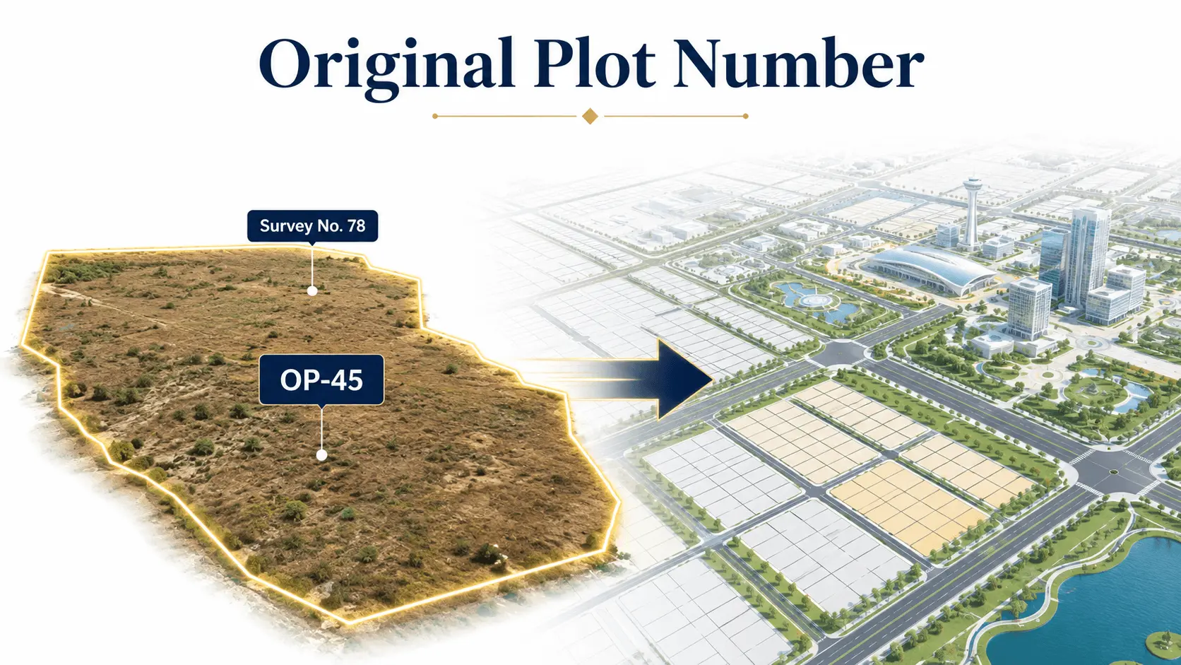
What Is an Original Plot Number?
An Original Plot, commonly abbreviated as OP, represents land within the Town Planning Scheme
before final reconstitution.
In simple language:
Your existing land parcels or survey lands are brought into the TP Scheme and represented as an
Original Plot.
For example:
Survey Number → Original Plot No. 45
The Original Plot creates a planning reference for the land as it enters the Town Planning process.
Official Dholera TP documents specifically identify OP boundaries and numbers in their planning
maps.
Is a Survey Number the Same as an Original PlotNumber?
Not necessarily.
This is a common source of confusion.
A Survey Number belongs primarily to the revenue-record system.
An Original Plot Number is part of the Town Planning Scheme framework.
Depending on the planning situation, one Original Plot may relate to:
- One Survey Number
- Part of a Survey Number
- Multiple survey parcels
Therefore:
Survey No. 100 does not automatically mean Original Plot No. 100.
Buyers should check the actual official mapping.
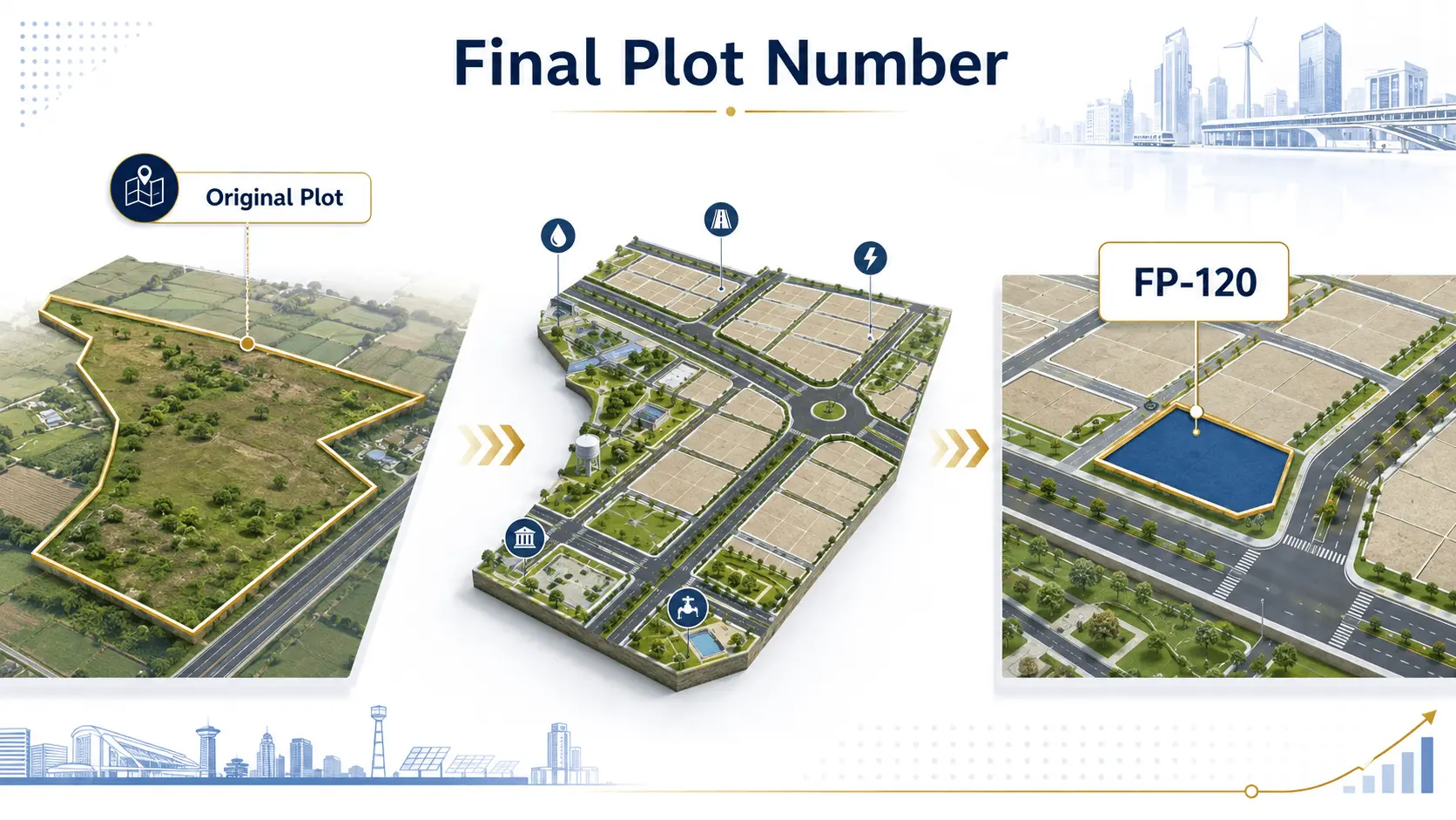
What Is a Final Plot Number?
The Final Plot Number, often written as FP Number, identifies the reconstituted plot created through
the Town Planning Scheme.
In simple terms:
Original land goes into the planning process → infrastructure and reservations are considered →
a Final Plot is reconstituted.
The Final Plot may differ from the Original Plot in:
- Area
- Shape
- Location
- Road frontage
- Boundary
Official Dholera TP maps show separate Original Plot and Final Plot boundaries, which is why buyers
should understand both references when reading project information.
Why Can the Final Plot Be Different From theOriginal Land?
Town Planning is intended to create an organised city.
Land may be required for:
- Roads
- Infrastructure
- Public facilities
- Utilities
- Other planning requirements
The planning process therefore involves land reconstitution.
For example, an irregular agricultural parcel without proper road frontage may eventually receive a
more usable Final Plot within the planned layout.
This is one of the fundamental concepts behind a Town Planning Scheme.
Survey Number vs Original Plot vs Final Plot
Here is a simple example.
Suppose Mr. A owns agricultural land.
Stage 1: Revenue Record
His land is recorded as:
Survey No. 150
This identifies the property in the traditional revenue records.
Stage 2: Town Planning Scheme
When the area becomes part of a TP Scheme, the land may be represented as:
Original Plot No. 72
Stage 3: Reconstitution
After planning for roads and other infrastructure, the land may receive:
Final Plot No. 72/1
This is only an illustrative example.
Actual Dholera Survey Numbers, OP Numbers and FP Numbers must always be verified through official
records.
Does the Final Plot Stay in Exactly the SameLocation?
Not always.
The purpose of reconstitution is to create a planned layout.
Therefore, a Final Plot can potentially be:
- Repositioned
- Reshaped
- Adjusted
- Provided different road frontage
This is why simply visiting the original survey location may not provide the complete planning picture.
Buyers should understand how the relevant OP and FP map applies to the parcel.
Can an Original Plot Fall in More Than One Zone?
Yes, this is possible in planning.
Official Dholera TP notification documents specifically instruct planners to verify Original Plots that fall
in more than one zone and reconstitute Final Plots according to the sanctioned Development Plan.
This point is especially important for investors.
It shows why buyers should not assume that the entire original agricultural parcel will necessarily retain
the same planning characteristics after reconstitution.
What Happens If Land Is Affected by a PlannedRoad?
Road planning is another reason TP maps are important.
Official Dholera TP documents include instructions concerning Original Plots affected by major planned
roads and their reconstitution.
For buyers, this means a property should be checked for:
- Road reservation
- Proposed road width
- Final Plot access
- Final Plot frontage
- TP road alignment
A property advertised as “road touch” should be evaluated using the official planning map, not only the
seller’s site sketch.
What Does OP-FP Map Mean?
You may frequently hear people in Dholera say:
Check the OP-FP map.
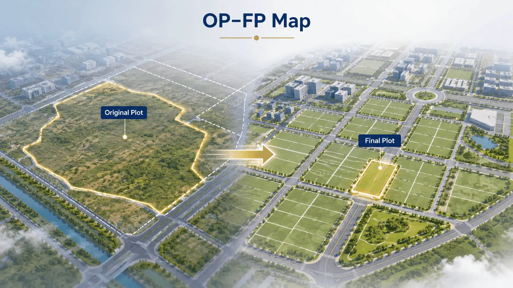
OP-FP simply means:
Original Plot – Final Plot
The map helps show the relationship between land before and after Town Planning reconstitution.
An OP-FP map can typically help buyers understand:
- Original Plot number
- Final Plot number
- Approximate boundaries
- Road network
- Adjacent plots
- Planning layout
Official Dholera documents publish these Original Plot–Final Plot plans for applicable schemes.
What Is a TP Number?
A TP Number identifies the particular Town Planning Scheme.
For example:
- TP Scheme 1
- TP Scheme 2
- TP Scheme 3
- TP Scheme 4
- TP Scheme 5
- TP Scheme 6
Dholera’s official planning page states that TP Schemes 1 to 6 together cover approximately 422 sq. km.
Knowing the TP Scheme is useful because different properties can fall within different planning areas
and development phases.
Is TP Scheme Number the Same as Final PlotNumber?
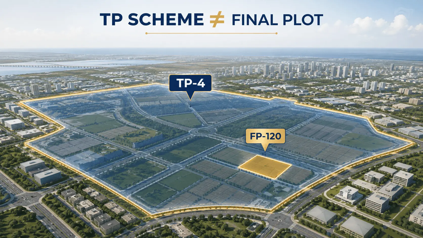
No.
For example:
TP Scheme: TP-4
Final Plot: FP-120
These numbers serve different purposes.
The TP Scheme identifies the broader planning scheme.
The Final Plot identifies an individual reconstituted plot inside that planning framework.
What Is a Development Plan?
A Development Plan, or DP, provides the larger land-use and infrastructure vision.
It can identify broad planning elements such as:
- Industrial zones
- Residential zones
- Commercial areas
- Transport corridors
- Public facilities
- Green areas
- Infrastructure
The Town Planning Scheme works at a more detailed implementation level within that broader planning
framework.
The official Dholera website states that the Development Plan and Town Planning mechanism are
central to the planning of Dholera SIR.
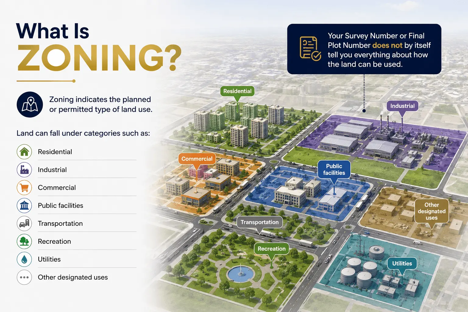
What Is Zoning?
Zoning indicates the planned or permitted type of land use.
Depending on the applicable Development Plan and regulations, land can fall under categories such as:
- Residential
- Industrial
- Commercial
- Public facilities
- Transportation
- Recreation
- Utilities
- Other designated uses
Your Survey Number or Final Plot Number does not by itself tell you everything about how the land can
be used.
You also need to understand the applicable zone and development regulations.
Why Buyers Should Not Check Only the FinalPlot Number
A Final Plot Number is important, but it is only one part of property due diligence.
A buyer should also understand:
- Survey Number
- Ownership
- TP Scheme
- Original Plot
- Final Plot
- Final Plot area
- Zoning
- Road access
- Development permissions
- Existing infrastructure
Property investment should never be based on one number alone.
Survey Number and Ownership Are DifferentConcepts
Another important distinction:
Survey Number identifies land.
It does not automatically prove that the person selling the land is the current legal owner.
Ownership should be separately checked through appropriate land and title records.
Therefore, having the correct Survey Number is the beginning of due diligence—not the end.
Final Plot Number and Ownership Are AlsoDifferent
A Final Plot identifies a parcel within the Town Planning framework.
It does not by itself replace the need to verify:
- Ownership
- Title
- Encumbrances
- Applicable records
- Sale authority
- Legal documentation
Official Dholera documents also note that certain Final Plots allotted to authorities can vest in the
authority under the applicable TP process.
This further demonstrates why FP information must be interpreted together with legal and planning
records.
How to Read a Dholera Property Description
Suppose someone tells you:
“The property is in TP-4, Survey No. 120/1 and Final Plot No. 185.”
Instead of accepting the description at face value, ask:
- Which village does the Survey Number belong to?
- Can I see the revenue record?
- Which Original Plot corresponds to this Survey Number?
- Can I see the official OP-FP map?
- Is FP-185 the correct Final Plot?
- What is the Final Plot area?
- What zone does the FP fall under?
- What road access does it have?
- What is the ownership status?
- What development permissions apply?
Official Dholera OP-FP maps themselves contain combinations of village, survey, OP and FP references,
showing why all of these identifiers need to be read together.
Disclaimer
Dholera City Buildconz is an independent real estate company and is not affiliated with DSIRDA, DICDL,
NICDC or any government authority. This article is intended for general investor education and does
not constitute legal or town-planning advice. Survey details, TP boundaries, Original Plots, Final Plots,
zoning, ownership and development permissions should always be verified through the latest official
government records and qualified legal or planning professionals before purchasing property.
Still Have Questions?
Get the answers you need, quickly!